PeakFinder is an app designed to help users identify mountains and peaks in their surroundings. The app uses augmented reality technology, the GPS receiver and built-in sensors of your mobile device to overlay information about the names and elevations of mountain peaks onto the camera view.
Platform
The mobile PeakFinder app is available on Android and iOS.
There is also a web version which isn't based on your GPS location, but instead allows you to "fly to" any location in the world and see the contours generated based on the Digital Elevation Model (DEM).
Using the App
Using the mobile app is simple - you point your phone somewhere around you and the app will draw the elevation contours that you should be seeing. These contours are generated based on your current GPS location, the compass and accelerometer sensor in the phone and the Digital Elevation Model (DEM). The app then prints peak names which are pulled from a GIS like OpenStreetMap and adds the elevation from the elevation model. That's a lot of calculations going on in the background, which demonstrates the processing power of today's smartphones and fine developer skills!
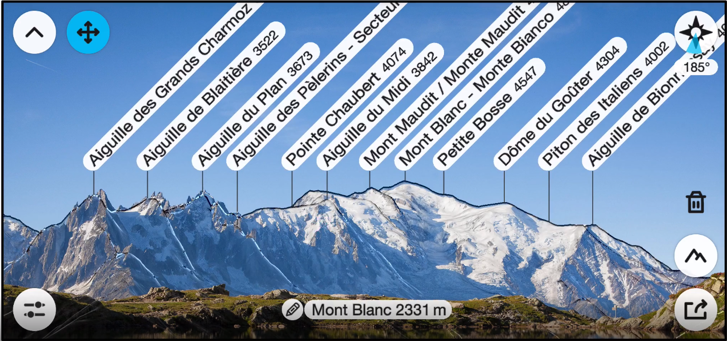
There is also a camera mode which will overlay the camera view with the generated contours. This results in peaks being labelled on your actual view, like in the following photo:
In telescope mode you can enlarge a small portion of the screen, like viewing it through a telescope. By enlarging an area the app may bring up some information about the enlarged peaks that hasn't been visible in the original screen.

There are a few other interesting options worth checking out, like:
- being able to "fly" over a certain terrain
- mark your favourite peaks
- set filters on minimal altitude for labelled peaks (for example if you want to display only peaks above 2000m)
- edit and export photos with peak labels
PeakFinder does not require an internet connection to work, so it can be used anywhere. It is advised to calibrate the compass on app launch.
Detailed instructions for using the app are available on the PeakFinder website.
Complaints
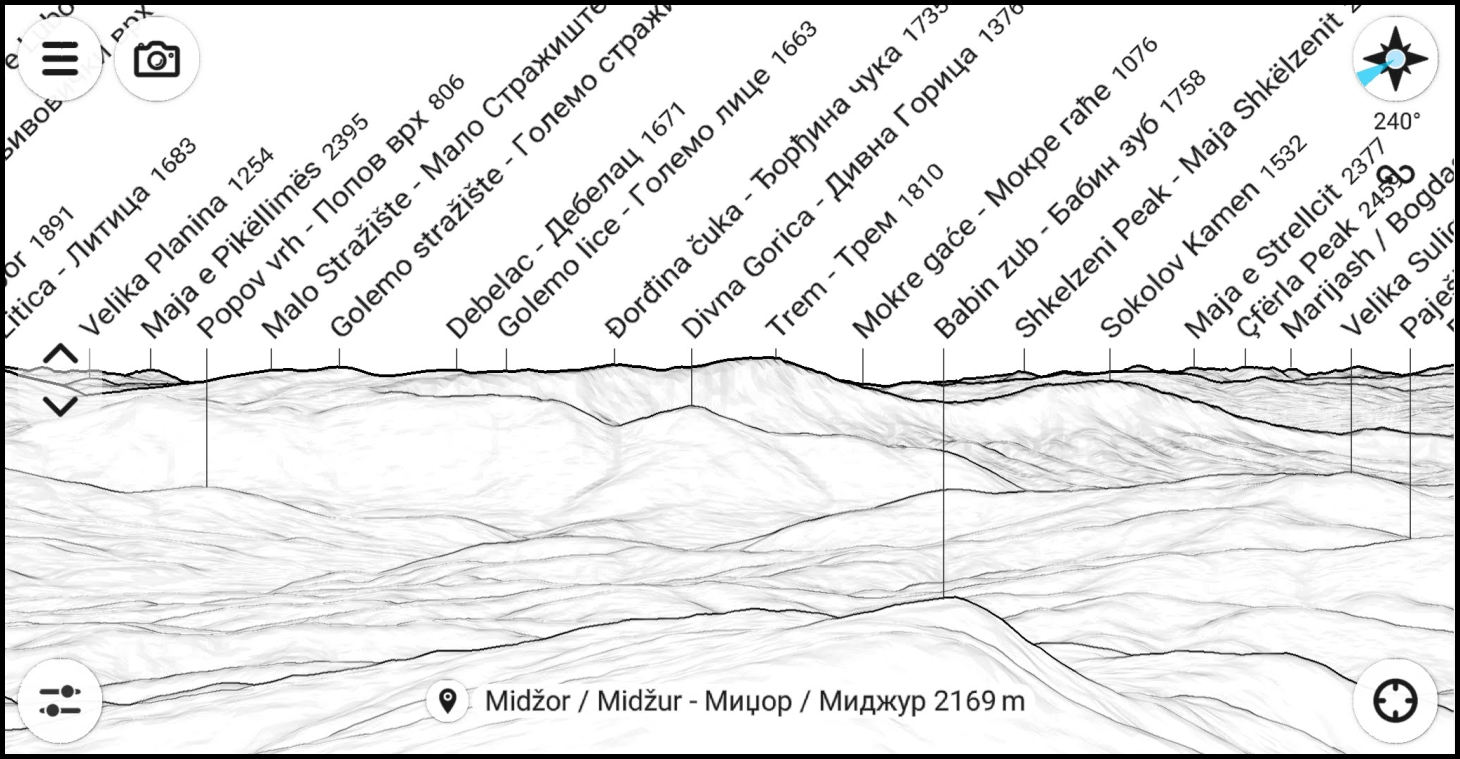
A mountain can have many peaks. PeakFinder shows peaks and generally ignores mountains, the latter often being better known than the peaks themselves. It would be nice to have the mountain name along side the peak name and altitude. As an example, the following screenshot shows a bunch of peaks in the distance, the closest ones around 70-80km away. Those peaks belong to several mountains which are better known than the peaks, but there is no information about what mountains those are.

Rating
As of November 2023, the app has been downloaded 500K+ times on Google Play, and has a rating of 4.4 out of 12.6K reviews.
Pricing
PeakFinder costs a one-time payment of 5 USD.
Some screenshotes are Copyright © PeakFinder.com
Comments
Powered by FastComments