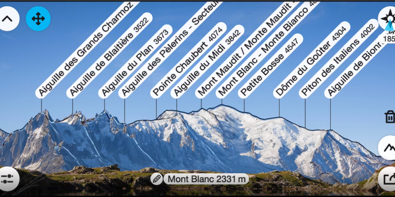
PeakFinder is an app designed to help users identify mountains and peaks in their surroundings. The app uses augmented reality technology, the GPS receiver and built-in sensors of your mobile device to overlay information about the names and elevations of mountain peaks onto the camera view.
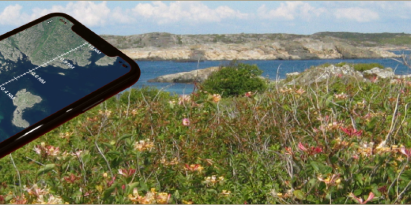
This little cool app is designed for classical orienteering and provides various features to help users find the direction and distance to their desired destinations. It is a versatile tool for orienteering enthusiasts and outdoor adventurers who need a digital solution for navigation. It combines traditional map and compass techniques with modern technology to assist users in finding their way to a specific location.
This is the first app I use when I need a quick insight of the direction and aerial distance to a geographical mark. It's also great for figuring out what village, river, lake or mountain you're looking at in the distance, and how far it actually is. I find this to be a very satisfying and nice tool. But there's a caveat - it only works if you have an internet connection as it relies on online Google maps. It would be fantastic if it could work with offline Google maps, but currently it does not.