Funded by the US National Science Foundation, implemented at the University of Minnesota, the "Flyover Country" mobile app is a very useful, unique and free app for Android and iOS, which enriches the exploration experience using offline maps whether you're flying, travelling by car, or trekking through nature's wonders. It is voted one of the best science apps available today by Popular Mechanic.
Flyover Country Overview
Flyover Country is more than just a navigation app; it's an educational tool that transforms your journey into an insightful adventure. Developed to cater to a diverse audience, the app seamlessly integrates with various modes of travel, offering a unique blend of utility and information.
The most useful feature of Flyover Country is it's offline access to a wealth of information. Once you prepare for your trip by downloading offline content along your route, you'll be able to access maps, Wikipedia articles for various landmarks on the ground (mountains, rivers, cities, areas, monuments, etc), but also geological information of the surrounding area which is the main goal of the app.
While creating the path you are presented with options to select the type of travel (ground/air) and the type of information you want to store offline. The type of travel is used to determine the area that will be downloaded for offline usage. For air travel a wider area is downloaded in order to cover all the area that can be seen from the plane, while in case of ground travel the width of the path is much smaller.
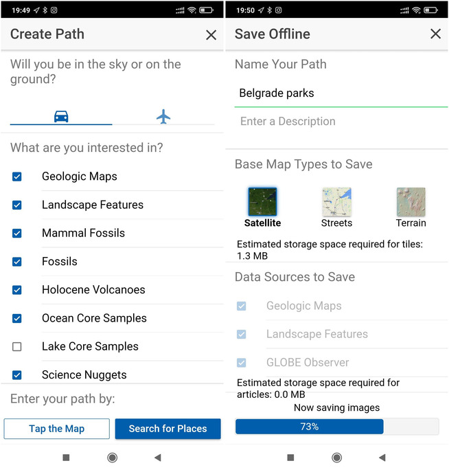
Defining the route is as easy as clicking areas on the map. In the layers menu you can select the layers you want to have displayed on the map:
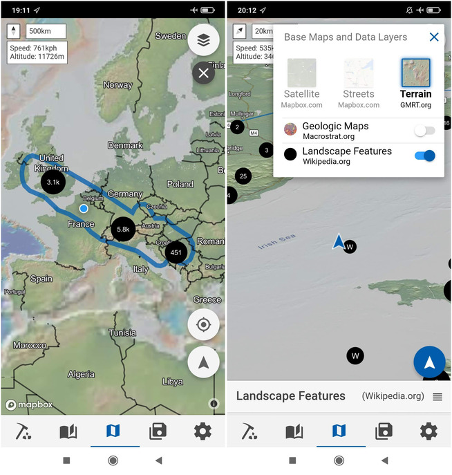
Travelling by Plane
For air travellers, Flyover Country revolutionizes the in-flight experience. Passengers can input their departure and destination points while on the ground, to access a treasure trove of information about the landscape passing beneath them while in-flight. The app is airplane-mode ready, using only previously downloaded content and the GPS receiver (which is safe to use in airplane mode), it provides real-time details about mountains, landmarks, and cities on the horizon.
A standout feature is the offline access to Wikipedia, ensuring users can delve into educational content even in areas with limited or no internet connectivity. So, whether you're flying over majestic mountain ranges or sprawling plains, Flyover Country turns your plane journey into a captivating geography lesson.
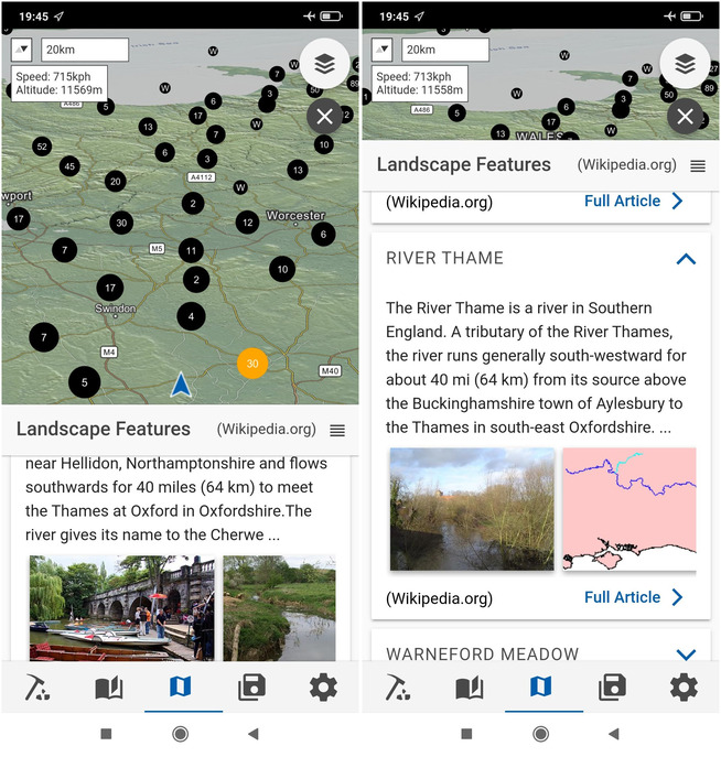
The following app screenshots were taken while flying over south England. You can see the phone is in airplane mode, but the location of the plane is shown on the map, with the altitude and speed in the upper left corner. You can also see Wikipedia articles opened for some landmarks close beneath on the ground.
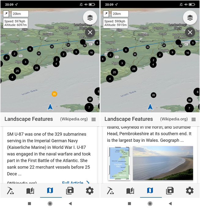
The following screenshots were taken while flying over the Irish sea, while exploring nearby landmarks - a sunken ship from WWI and Cardigan Bay in Wales.
Travelling by Car
But the app's capabilities don't end at 10,000m. Travelling by car becomes an equally enriched experience with Flyover Country. As you navigate the highways, the app continues to provide real-time information about the geological features and points of interest along your route. It's your digital guidebook, offering insights into the diverse landscapes passing by your window.
The offline access to Wikipedia becomes particularly handy during road trips, ensuring that you stay informed about the regions you traverse, even when you venture off the beaten path.
Hiking
Flyover Country can also be quite useful for hikers. The app's offline maps (provided by Mapbox) and GPS capabilities can guide you through trails, but where it excels is offering information about geological formations, wildlife, and historical landmarks. Hikers can access detailed maps that overlay geological features, providing a deeper understanding of the terrain.
As you explore the great outdoors, Flyover Country's integration with Wikipedia becomes an educational beacon, offering insights into the geological history of the areas you're trekking through. It's a nature hike with a knowledge boost, allowing you to connect with the environment on a more profound level.
Conclusion
In a world where technology often isolates us from our surroundings, Flyover Country stands as a testament to the power of innovation in enhancing our connection with the world. Whether you're gazing out of an airplane window, cruising on a road trip, or trekking through nature's wonders, this app seamlessly integrates into your travel experience. With its offline access to Wikipedia, Flyover Country is not just a navigation tool; it's your educational companion, turning every journey into an opportunity for discovery and learning.
Comments
Powered by FastComments